 Home Page
Trip to Tasmania
 May 2023: To save Server space, nine years down the track, I have now replaced all the individual photos on this page with one large image. Click the small image (right) to enlarge, [X] to close.
 November 2014: It’s been 4 years since I moved from Brisbane to Maleny, and Fiona & Chris moved to Tassie with Erin & Aleron... at almost exactly the same time. I have seen them very briefly a couple of times since then as they visited Brisbane, but it was timely to visit them. I had in mind a driving tour of Tassie but, on arrival, discovered all sorts of reasons why that was not an option. Best-laid plans ’n all that. So for the first week, with Aleron still at school in Deloraine, we made day-trips to places around the northern third of Tassie. Chris was on holiday, so this was quite convenient, although neither he nor Fiona seem capable of driving more than an hour before the withdrawal symptoms kick in... they must stop at a café or bakery for coffee and cakes! I like my coffee, too... but there are limits. Perhaps my withdrawal symptoms are not as bad as theirs?
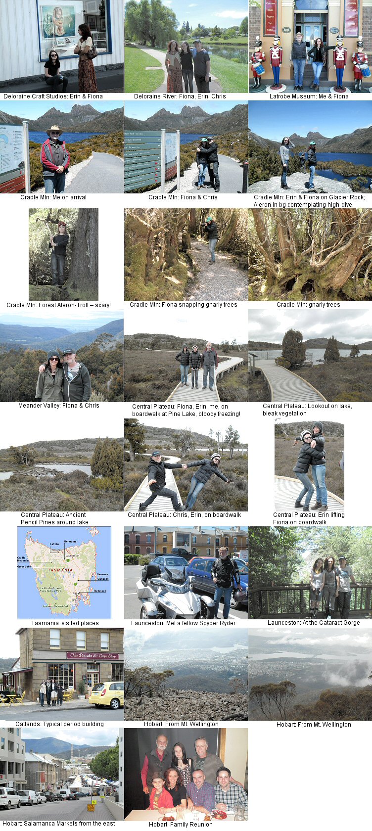
First Day-trip: ...first day was just around Deloraine to get a feel for the town – main street banana-shaped and slightly uphill to follow the river, so you can’t see one end of town ( about twice the size of Maleny ) from the other. Nice little town, about half-way between Devonport and Launceston, so lots of tourists break their trip there. Visited the Deloraine Craft Studios, where Fiona has a studio, and walked along the river, which has a pleasant atmosphere.
Then, next day, off to Devonport ( where the ferry from Melbourne docks ) via Latrobe, where there is a quaint “Olde Curiosity Shoppe”... or what I imagined that this would look like. Two floors stuffed with bric-a-brac from the 18th, 19th and early 20th centuries, plus some more modern stuff, some for display only but some for sale. Among the displays was a looping video promo for the ‘Mad Millie’ Cheese-making kits, showing a class with the Italian Kit being demonstrated... I attended that very class in Maleny the week before flying to Tassie! On the way back, stopped at a chocolate factory where I had a disgusting chocolate milkshake – more chocolate than milk – but Fiona & Chris had their coffee fixes. Aaaaahhh! Up here at the northern end of the island, you can see that the mainland habit of bulldozing old buildings to make way for newer ones is nowhere near as prevalent. Older buildings more commonly move on to different purposes, that’s all, so all towns have a hybrid ‘period’ atmosphere. This was to become far more obvious later as we moved further south.
Second Day-trip: ...up to Cradle Mountain. Very few buildings up here to bulldoze. Very noticeable that the vegetation changes as you ascend, until it is pure alpine by the time you reach the lake, with very weathered, stunted trees, and all forested areas are covered in moss. We took the short walk to Glacier Rock, looking out over the lake, then drove a short distance to a memorial reconstruction of a pioneer lodge surrounded by a gnarly forest. Quite spooky.
Third Day-trip: ...up through the Meander Valley to the Central Plateau and Pine Lake, then Great Lake. Next time I go to Tassie I will take a leisurely trip down past the Great Lake from Deloraine to Hobart, rather than use the rather boring main road straight down the center of the island. Scenery up there is wild and magnificent, up at 1200m elevation, but the temperatures are frigid, and this was early summer! Our trip was just a day-trip from Deloraine down to the Great Lake, then back again. The road would be impassible in winter, and has several unsealed sections, but is far more interesting to me than a plain highway.
In general terms, the triangular shape of Tasmania can be separated into west and east by the line taken by the eastern edge of the Central Plateau, west of the main highway from Launceston down to Hobart – wild and bleak, forested and wet on the western half; prettier, pastoral, drier and more settled on the eastern half. The further south you go, the more ‘English’ the buildings are – mostly stone and styled from the 18th and 19th centuries.
Fourth Day-trip: ...well, this was really a combination of two day-trips. Launceston is an interesting town ( where Erin goes to College ) about 40 minutes from Deloraine, located in a natural bowl, so that all the suburbs ring it and there are houses clinging to steep slopes everywhere you look. Once again my Mainland Eye noticed the old buildings now serving duty as something other than their original purposes, so that the town is a hotch-potch of period styles – I quite like that. I met a local Spyder rider there in a supermarket car-park, but bikes, in general, are mostly ridden by mainlanders on holiday... I guess the severe winters make them unpopular for locals. On our second visit we went to Cataract Gorge, which is a pretty place. The ‘sleepy hollow’ feel of Launceston quite appealed to me, since I don’t like cities at all usually.
Fifth Trip: ...this was a bigger one. During the Deloraine Craft Fair the week before my visit, Fiona had spoken to a gallery owner from the pretty village of Richmond, on the northern outskirts of Hobart. Definitely part of the tourist trail, being all colonial in style, and he wanted some of her work for the gallery. So this, plus the fact that Erin needed to get her driving hours up to qualify for her P-plates, dictated that we would ALL go to Hobart, using both cars. That was the first main factor that determined the trip. The main road down the center of the island is on the eastern side of the climate divide, so is mostly pastoral, and studded with small villages and towns all the way. We stopped at Oatlands for lunch ( for the essential coffee fix ), and it almost seemed a little strange to see locals dressed in modern clothes! The further south you go, the more colonial and picture-postcard it becomes.
Hobart itself is a jewel of a place, with Mount Wellington looming on the southern side and the Derwent River estuary snaking through the town, and that huge bridge spanning the river. We stayed at a resort on the northern side, near to the airport. One of the things that I had wanted to do was to visit the Salamanca Markets, run in the center of the docklands area every Saturday – glad we did that, because it really is a huge outdoor market, but... in the end, selling much the same stuff you would see in smaller markets anywhere, so been there, done that. Driving up Mt. Wellington was great, although it was icy and windy at the very top with poor visibility, but we caught some good views of the city on the way down again. The second main factor leading to the trip was that Eric had flown down from Toronto and was in Sydney working on a new George Miller movie, and Terry had also flown down. George had to fly to LA for a meeting over that particular weekend, so the film crew had a light work-load, and Eric could get away. He and Terry flew to Hobart, and we had some time in the city, then a great Italian meal at a restaurant at Sandy Bay, just outside Hobart.
The last day was a bit of a scramble, since I had to fly out of Launceston mid-afternoon, but we left Hobart and drove up the east coast as far as Swansea ( good fish ’n chips, there! ), then turned inland to join the main central road again, arriving at Launceston airport right on time. Not bad, considering that Erin was unable to exceed 80kmh anywhere on her L-plates.
• back to top •